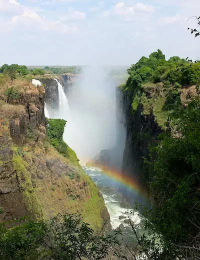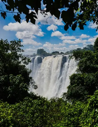
In the Lozi language they are called Mosi-oa-Tunya, the smoke that thunders. David Livingstone reached them in 1855 and named them after Queen Victoria. They are neither the highest falls in the world nor the widest, but taking width and height together they form the largest curtain of falling water on the planet.
How they are formed
The Zambezi flows wide and slow across a basalt plateau, then plunges into a fissure in the rock and continues through a series of zigzag gorges. The face is divided into five falls, from west to east: Devil’s Cataract, Main Falls, Rainbow Falls, Horseshoe Falls and Eastern Cataract. The highest point, 108 metres, is at Rainbow Falls.
Two sides, two visits
The Zimbabwe side, with its national park and the small town of Victoria Falls, faces the falls head-on and offers the widest views, especially of the Main Falls. The Zambia side, with Mosi-oa-Tunya National Park and the town of Livingstone, lets you get closer: from the Eastern Cataract you can reach Livingstone Island and, at low water, Devil’s Pool.
Between the two sides stands the 1905 bridge, and a real border with its own controls.
When to go
After the rainy season, roughly between February and May, the flow is at its peak: the spray rises hundreds of metres and can be seen from far away, but it sometimes hides the view and you get completely soaked. At the end of the year, before the new rains, the flow drops sharply and the face breaks up into separate channels; on the Zambian side some stretches are almost dry. At high water, on full-moon nights, you can see the lunar rainbow.
Around the Falls
Upstream, the Zambezi can be explored by boat at sunset and by canoe. A few hours’ drive away, in Zimbabwe, is Hwange National Park, known for its great concentrations of elephants; further north, in Zambia, is South Luangwa, the birthplace of the walking safari.